
One thing to scratch off the sabbatical bucket list (and the Cal Poly bucket list too): I hiked the P today for the first time since coming to San Luis.
The first part of the trek is the discovery of the numerous layers of student parking behind the dorms. Terrace upon terrace until one arrives to this strange building at the top without visible windows or doors (technically, two buildings - there is a gap between them) The trailhead is far from obvious. I had to pull out the phone and discovered that you were supposed to jump the fence to start the trail. Lots of horse manure on the other side.
Well, I am finally doing this.

The is is decorated as candy cane. Approaching it presents opportunities for shots at some interesting angles.


The stairs alongside the P are quite crooked and also fairly hard to climb. The first step, I think comes at around hip level.

Right at the bottom of the P is a good place to take some shots too.
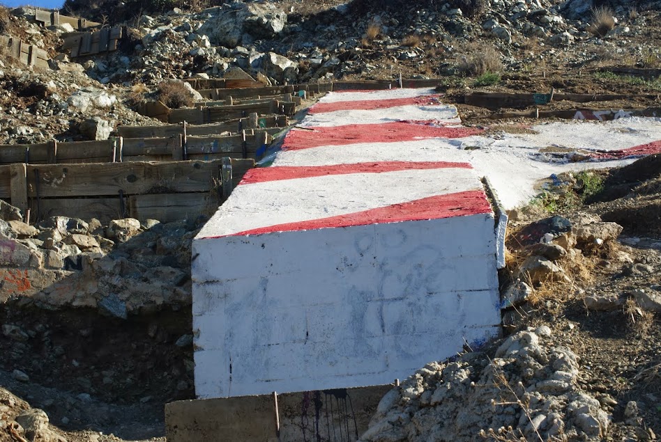
Question answered. The P is made out of concrete. The pictures above do not do justice to the angle it is lying at - it is significantly steeper, to the point of it being close to impossible to actually stand on its surface without slipping. I decided against trying to jump into the middle of the P. Putting the camera at the bottom of the leg yielded the following shots.


My favorite shot of the P itself actually came when I got to the top of it.

Here is the matching shot of the curve part. The main trail that goes past the reservoir is at the background. I cut the trail and went directly up using a steeper, but shorter trail, which, I think, is what students mostly use (judging by the amount of empty bottles of beer and vodka I saw on the way up).

No trip to the top is complete without landscapes. My 18-55mm lens got dirty somewhere in the climbing process, so the shots taken by it contain some unfortunate artifacts and are omitted. The shots taken with the other lens (my 55-200mm one) are less panoramic. Still, I like some of the shots quite a bit. Starting with my favorite one:

What a difference a CPL filter makes. I really dig how blue the ponds turned out. They most certainly did not look that nice from above - more dark grey.... For non SLO-residents: the building complex in front of the picture is dorms; another set of dorms is directly behind it, to the right of the parking lot. Beyond, going west towards Morro Bay and the ocean are Cal Poly ag fields, and the trunks of some of the hills called the Nine Sisters are visible at the back.
This is the view of the campus core and the adjacent part of San Luis. I probably messed up the horizon a bit (not hard to do with the sun and the bumpy trail). The new science building is front and center. The CS building is also in the central part of the picture - it's the building with what looks like solar panels on the roof.

Four of the Nine Sisters (Biship's Pick, Chumash Pick, Cerro Romualdo and Hollister Peak, I think). The kit lens is starting to get dirty, unfortunately. Route 1 is clearly visible cutting the shot, so are Cal Poly's ag facilities. I may be wrong, but I think this is the first picture I took that actually shows four of the nine hills (my usual shots are taken from the top or the side of Cerro San Luis, and Hollister Peak is not visible from there).

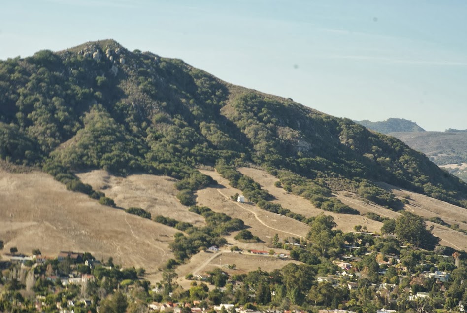
Finally, here is a shot of Cerro San Luis. Not the best color and composition, but our house is visible (-:
All in all, turned out to be a shorter and easier hike than I expected. Looking at the P from our house the impression is that it's a pretty steep and long-ish climb (kind of like getting from the trailhead next to us to the top of Cerro), but it turns out that it really isn't. I did not get to the top of the ridge - that's next hike, ending my climb at the lone tree above the P.
For completeness sake, here are some old pictures (from Fall of 2007) of the P from the spot just below the water tower on the side of Cerro San Luis (see pic above). Both the trail I took up (leading straight to the P from the below) and the trail I took back (to the left of the image) are plainly visible on the second image.


No comments:
Post a Comment